伊能忠敬について
こんにちは。
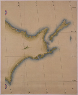
伊能忠敬は千葉県九十九里浜のほぼ中央部に位置する小関村(現・九十九里町)に生まれました。忠敬は村役人として活躍し、領主から村方後見に任命されました。このまま悠々自適老後を送るかと思いきや、50歳の時に天文学を学ぶため、江戸に向かいました。天文学を学んでいるうちに江戸から蝦夷地の距離を測ることで地球の大きさが分かるのではないかと考えました。そして忠敬が55歳の時に日本地図を作ろうと測量の旅に出発しました。そして17年間で10回の測量を行い、累計約4万キロメートルを歩きました。忠敬が作った地図の精度はものすごく正確で幕府も驚くレベルでした。そして地図を作成する作業の最中、73歳でこの世を去りました。
下の展示を見てもらって伊能忠敬についてもっと皆さんに知っていただきたいです。
- Japanese Map
東京国立博物館,Tokyo National Museum
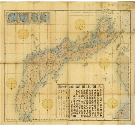
<p>In the early-19th century, Ino Tadataka surveyed the entire nation of Japan on foot and produced a detailed map of Japan. This is a famous episode in Japanese history. Tadataka made maps at three different scales, small, medium and large. This is his medium-scale map, which represents the Japanese Archipelago at 1:216,000 scale across eight charts. It accurately records land elevation and bearing, and mountains, rivers, roads, harbors, castles, temples, and more are marked on it with minute labels. Its precision compares favorably even to present-day maps. Its careful lines and colors make it impressive as a painting as well.<br /><br />Ino Tadataka embarked on his nation survey in 1800 at the age of 56, far from young for the time. He divided Japan into areas and completed the project over the course of 17 years and 10 expeditions. The survey teams led by Tadataka traveled all of Japan on foot carrying specialized equipment, produced maps of each region based on the results of their survey and submitted their maps to the samurai government in Edo. Even after Tadataka’s death in 1818, his apprentices carried on his work compiling the results of his surveys into maps. In 1821, they completed the 255-page compilation and submitted it to the samurai government as a finished work, with three pages for the small map, eight for the medium map, and 214 for the large map. The edition they submitted to the government was, unfortunately, destroyed by a fire in 1873, but copies made based on the same survey data and maps submitted before the compilation survived. The Tokyo National Museum has a number of these high-quality copies and pre-complete-edition maps in its collections. This map is one of them. It was previously passed down through the Matsudaira clan of Yoshida Domain, Mikawa Province in present-day Aichi Prefecture. At the time of Tadataka’s survey, a member of this clan held an important post in the samurai government.</p>
ここでは伊能忠敬が作った伊能忠敬日本地図の説明がされています。
- 尺璧帖 伊能忠敬
東京文化財研究所撮影,東京文化財研究所
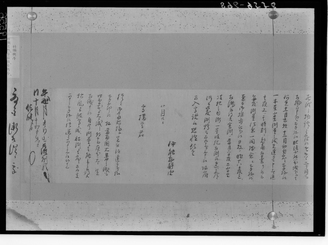
<p>東京国立博物館が所蔵する「尺璧帖」(機関管理番号:B-2390)を東京文化財研究所で1930~1955年頃に撮影したガラス乾板です。作品名等の情報は撮影時の調査記録を元に記載しております。現在の作品名等については各所蔵機関の情報をご確認ください。</p>
ここでは伊能忠敬の尺璧帖の説明がされています。
- Tadataka Ino
A geographical surveyor of the Edo period who created the first map of Japan using surveying techniques
ここでは伊能忠敬の一生を知ることができます。
- Ino Maps
The first scientific maps of Japan based on actual measurements, created from surveys by Tadataka Ino and completed by Kageyasu Takahashi
ここでは伊能忠敬の作った日本地図の説明がされています。
- Kageyasu Takahashi
An astronomer and geographer of the mid-Edo period who oversaw the surveying work of Tadataka Ino, and who completed the Ino Maps
ここでは伊能図を完成させた高橋景保の説明がされています。
今回の展示で伊能忠敬について知っていただけましたか。伊能忠敬は他の有名な人物と比べるとあまり有名ではなく、名前が挙げられることがあまりありませんが、50歳を過ぎてから天文学を学び始め、55歳で全国測量の旅に出るというものすごくすごいことをした人物です。この展示をきっかけに伊能忠敬に興味を持っていただけたら嬉しいです。ご視聴いただきありがとうございました。
次に伊能忠敬の展示会を紹介します。
https://hakubutsukan.city.toyota.aichi.jp/exhibitions/special/14
この展示会は2026年1月31日(土)〜2026年3月29日(日)まで行われます。伊能忠敬の使用した測量道具、自筆の記録類などを見ることができるため、ぜひ行ってみてください。
https://www.city.katori.lg.jp/sightseeing/museum/schedule.html
この展示会は2026年1月20日(火)〜2026年3月22日(日)まで行われます。収蔵品展では、当館所蔵資料の中から数点の実物資料を展示します。また、特定のテーマに沿って当館所蔵資料を展示する企画展と、他館の所蔵資料を組み合わせながら展示する特別展を開催しています。 こちらもぜひ行ってみてください。