Description
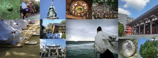
昭和22 年に地理調査所が作成した地形図。図からは、島のほとんどが山地であることが読み取れる。南側に集落があり、海岸から山頂に向かって縦貫するふたつの道と、西にある神社(小鷹神社)から東に横断する通りが確認でき、道を挟むようにして家屋が建ち並んでいる。〔No.512 島とくらし―玄界島―〕
Data source
Fukuoka City Museum Collection Database
Fukuoka City Museum opened in October 1990 and its mission was to research Fukuoka’s history and folklore and to share it with the world. Fukuoka is located at the western tip of the Japanese archipel...
Contents holder/Provider
Aggregator
Fukuoka City
Fukuoka City has been connected to the world through the sea, and has nurtured its own unique culture and character throughout its long history. With such a multilayered historical and cultural background, the city continues to develop as a vibrant city with its unique culture that is still alive today. Each cultural facility in Fukuoka City houses, stores, and discloses materials related to the history and culture that have been preserved and inherited by the local people for a long time.
Last updated
July 14, 2026